Our members are dedicated to improving road safety and sharing their knowledge with the wider community. Here, you can explore our members' good practices – initiatives that have been assessed for their effectiveness in addressing a road safety problem and have proven results.
Get inspired – and sign up to share your good practices too!
Wednesday, March 19, 2025
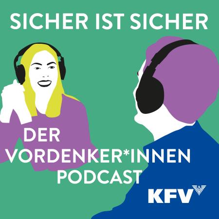
The overall target of the KFV podcast is to provide important and usefull tips for people who care about their personal safety and the well-being of their loved ones in the everyday life.
In each episode of the KFV podcast, two KFV experts talk for around 20 minutes about a topic from everyday life: about current issues of safe road traffic as well as accident-free relaxation during sport and exercise in nature, but also about the pitfalls of getting older as well as the turbulent life with children and teenagers.
With life experience, specialist knowledge and a good dose of humour, both moderators provide important tips and back ground information about accident risks, accident occurrence and accident prevention.
Here is a little taster of the content of the first three episodes published in March 2023, April 2023 and May 2023:
Episode 1: ‘L17: the best route to a driving licence?’
L17 is currently the most comprehensive driver training course on the way to a B driving licence. But driving the first 3,000 kilometres with your own child at the wheel can be nerve-wracking. Is the effort, courage and extra work really worth it?
On air: Monday, 11 March 2023
Episode 2: ‘Starting the motorbike season: why are masking effects life-threatening and ellipses life-saving?’
Motorcycling is back in fashion among the 40-plus generation. Since 2000, the number of motorbikes in Austria has more than doubled. But the streamlined silhouette is also the greatest danger: single-track bikes are virtually invisible in many traffic situations. How can motorcycling remain a safe pleasure?
On air: Monday, 17 April 2023
Episode 3: ‘Children & water: fascination, pleasure, risk. How to ensure water fun - with safety!’
Children and water - that means fun, but it's also a risky combination. For small children, paddling pools just a few centimetres deep can be disastrous if left unattended. What are the best safety measures for swimming pools, garden ponds and the like?
On Air: Monday, 15th May 2023
Since March 2023 the KFV Podcast has been published with a new episode once a month.
Friday, March 7, 2025
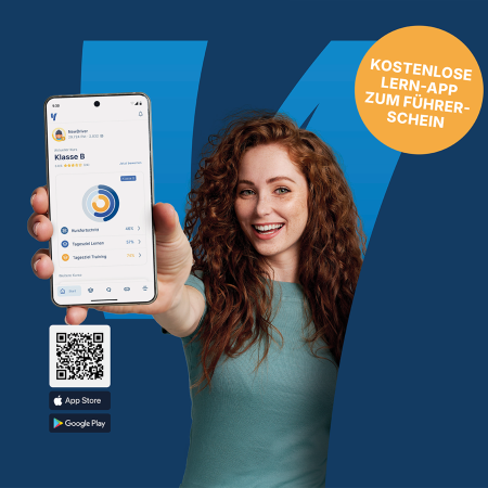
Traditional driving license training often relies on printed books and passive learning methods, leading to a lack of engagement and incomplete comprehension of critical road safety concepts. Young learners, in particular, benefit from interactive and digital learning experiences. The Austrian Road Safety Board (KFV) recognized this gap and developed the mobile and web app "Yarrive" to enhance road safety education through a modern, interactive, and gamified approach. The objective is to shift from rote memorization to true understanding, ultimately improving driver competence and road safety.
Tuesday, February 18, 2025
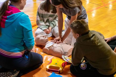
The Technical Day held at Braslovče Primary School on February 23, 2024, in collaboration with the VOZIM Institute, was both practical and educational. The students were first introduced to the DRAJV app and analyzed traffic safety in the municipality. During the event, they created posters and presented proposals to improve safety, which were also supported by Mayor Tomaž Žohar. The students participated in activities at seven stations, including an e-scooter simulator and workshops led by representatives from the Police, the Braslovče Fire Department, and the Žalec Health Center. The VOZIM Institute ambassador, Janez Hudej, shared his personal story about a traffic accident, which gave the students a deeper insight into the seriousness of road safety. The event emphasized the importance of involving young people in shaping road safety solutions.

Sunday, February 16, 2025
REMOVING TRAFFIC CONGESTION
We conducted an experiment at the JRC (Ispra, Italy) in a controlled traffic environment to ensure safety. The test consisted of a platoon of vehicles with the following configuration:
A first vehicle with a human driver following his usual behaviour on the road.
A second vehicle equipped with Adaptive Cruise Control (ACC).
Several conventional drivers keeping their safe distance.
Multiple tests were conducted with different groups of drivers, who were given inertial driving training.
The results have been surprising:
✅ Increased road safety.
✅ Significant reduction of traffic jams (better mobility).
✅ Lower fuel consumption and reduced pollutant emissions.
✅ More relaxed driving and less stress for drivers.

Thursday, February 13, 2025
The event focuses on an initiative aimed at improving road safety for young people, especially e-scooter and e-bike users. A survey by Zavarovalnica Triglav showed that only a little over half of young people feel safe when riding an e-scooter, and many have already experienced accidents. The lack of protective clothing, helmets, and reflective accessories contributes to greater risks. In the "Ne bluzi, z glavo kruzi" (Don’t Play It Cool, Use Your Head) initiative, the Vozim Institute, Zavarovalnica Triglav, and Yootree Creative agency collaborated to encourage safer e-scooter use among young people. By working with design students, they created a unique collection, "Dejmo se videt" (Let's Be Seen), of reflective clothing that combines safety with modern style. The collection was presented on October 17, 2024, at Ljubljana Fashion Week.The students used innovative reflective materials to design fashionable yet safe products. The collection was presented at Ljubljana Fashion Week, where it gained significant attention. The goal was to raise awareness about the importance of visibility in traffic, especially during the autumn and winter months. The initiative continues with workshops and public events, aiming for the products to become part of young people’s everyday style. The main goal of the initiative is to reduce the risk of accidents and encourage young people to prioritize safety while maintaining their personal style.