Initiative details
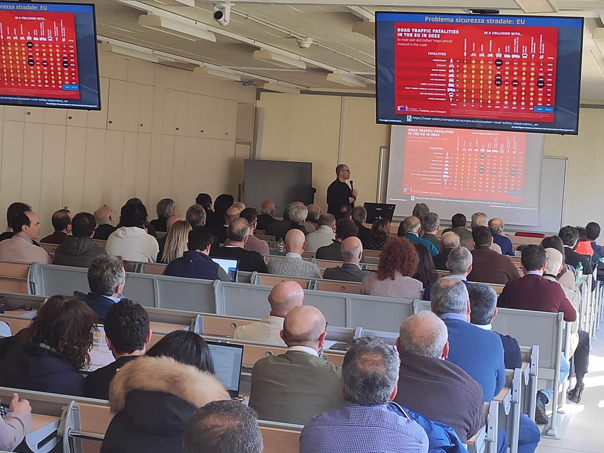
Guardrails installed on road bridges are essential to the safety of vehicles and road users. May accidents happen every year, involving vehicles falling from bridges with often fatal consequences. These issues have caused, in Italy, in the last decade, more fatalities than bridge collapses, even if we count the Morandi bridge collapse victims.
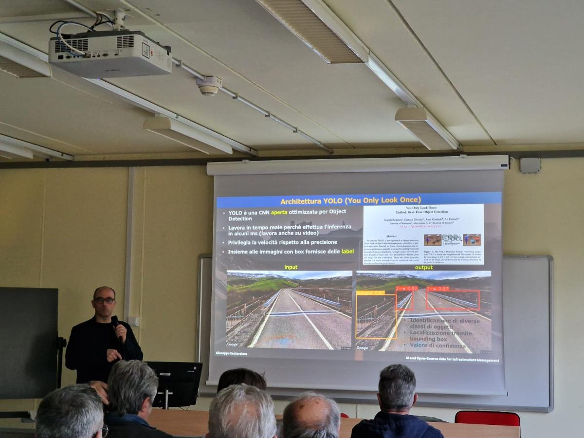
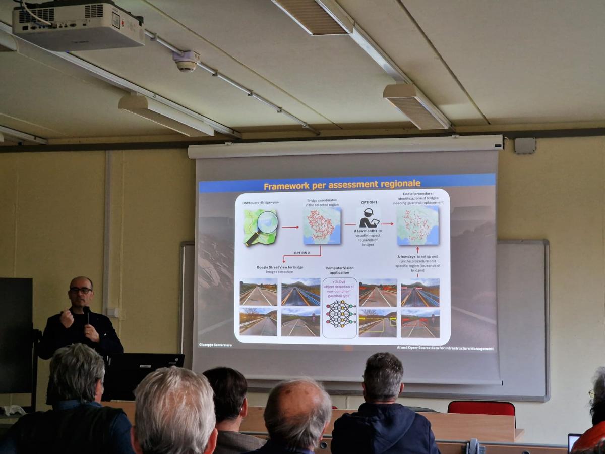
Many infrastructure managers, especially at the local level, often lack accurate and up-to-date inventories of the safety barriers on their bridges. Moreover, the limited availability of financial resources, combined with the lack of personnel, makes it difficult for these entities to effectively assess the condition of such critical infrastructure. This proposed technology is represented by an integrated methodology to automate the assessment of road guardrails installed on bridges using open-source data and deep learning (DL) algorithms. It innovatively uses YOLO (You Only Look Once) object detection algorithm to classify the safety barriers to establish whether they match the current standards. To speed up the evaluation process, the software tool involves the extraction of bridge information from OpenStreetMap (OSM) to construct a database of existing bridges, which most road management bodies miss. This is integrated with Google Street View API, for the extraction of images of each bridge’s safety barriers to be analysed by YOLO. The synergic concatenation of these three steps (OSM, Google Street View, YOLO) into a unique software tool, provides road managers with a cost-effective and efficient tool to remotely survey the guardrails installed on their bridges, permitting to timely identify bridges needing barrier replacment.
Many infrastructure managers, especially at the local level, often lack accurate and up-to-date inventories of the safety barriers on their bridges. Moreover, the limited availability of financial resources, combined with the lack of personnel, makes it difficult for these entities to effectively assess the condition of such critical infrastructure. This proposed technology is represented by an integrated methodology to automate the assessment of road guardrails installed on bridges using open-source data and deep learning (DL) algorithms. It innovatively uses YOLO (You Only Look Once) object detection algorithm to classify the safety barriers to establish whether they match the current standards. To speed up the evaluation process, the software tool involves the extraction of bridge information from OpenStreetMap (OSM) to construct a database of existing bridges, which most road management bodies miss. This is integrated with Google Street View API, for the extraction of images of each bridge’s safety barriers to be analysed by YOLO. The synergic concatenation of these three steps (OSM, Google Street View, YOLO) into a unique software tool, provides road managers with a cost-effective and efficient tool to remotely survey the guardrails installed on their bridges, permitting to timely identify bridges needing barrier replacment.
Initiative date
Who was/is your target audience?
Policy makers
Public authorities
Company employees
Public transport
Topic
Improve vehicles and infrastructure
Provide alternative solutions
Organisation details
University of Basilicata, Italy
School / Research centre
Italy
Potenza
Contact name
Giuseppe Santarsiero
Telephone number
+393282627474
giuseppe.santarsiero@unibas.it
Website link
Project activities
If you work together with external partners, list the most important partners and briefly describe their role.
Throughout the development of the proposed methodology, interactions with ANAS (Major Italian road management body) and technical staff from several local administrations provided valuable insights into the real-world challenges of managing bridge safety barriers. Meetings and informal discussions were held to understand their current practices, data availability, and limitations in conducting regular inspections. These professionals highlighted the lack of updated inventories, especially for minor roads, and the difficulty in accessing bridges located in remote or mountainous areas.
They also pointed out the shortage of specialised personnel and the high costs associated with traditional inspections, which often require lane closures and specialised equipment. Many expressed interest in low-cost, remote solutions that could help prioritise maintenance interventions based on objective criteria. Their feedback emphasised the importance of automating tasks like image collection, classification of barrier types, and condition assessment.
These exchanges were crucial in shaping the design of the tool, especially in defining the level of detail required for classification, the need for explainable results, and the importance of integrating geographic data. Their input helped identify key functionalities to include, such as batch processing of multiple bridges and the ability to export results in formats compatible with existing asset management systems. This collaboration ensured the methodology responds to actual operational needs.
Please describe the project activities you carried/are carrying out and the time period over which these were implemented.
The development of the proposed tool involved a series of coordinated activities, starting with the creation of a dataset of bridge safety barrier images. Photos were collected using the Google Street View API based on coordinates extracted from OpenStreetMap (OSM). Each image was manually annotated to label different types of guardrails and to train a YOLOv8 object detection model. The dataset was split into training, validation, and test sets to ensure robust model evaluation.
Once the model was trained, its performance was assessed using standard metrics such as accuracy, precision, recall, and F1-score. Special attention was given to recall, given the need to identify all potentially non-compliant barriers. Following model validation, a set of VBA routines (Excel macros) was developed to integrate the three core components: OSM data extraction, automated image retrieval via the Google Street View API, and image classification through YOLO inference.
These routines were combined into a single pipeline capable of processing a list of bridge locations, retrieving corresponding images, classifying the visible barriers, and exporting structured results, including confidence scores and classification labels. The tool also included logic to detect missing or incorrect images and allowed manual correction when necessary, enabling a practical, semi-automated solution for large-scale assessments.
In terms of implementation, what worked well and what challenges did you need to overcome?
The proposed methodology demonstrates strong potential for enhancing the management of bridge safety barriers. Its main strengths lie in the use of open-source data (OSM, Google Street View) and deep learning (YOLOv8), enabling low-cost, scalable, and rapid assessments. The integration of geospatial data and object detection into a single workflow allows local authorities to remotely evaluate hundreds of bridges in hours—an enormous time and cost advantage over traditional inspections.
The methodology performs well in terms of accuracy (0.912), recall (0.928), and precision (0.900), particularly excelling in identifying non-compliant barriers. High recall is crucial, as missed detections could pose serious safety risks. The uniformity of guardrail types in countries like Italy allows for model generalisation across regions. Additionally, the software's lightweight requirements make it accessible to entities lacking high-end computing resources.
However, challenges remain. Inaccurate bridge coordinates can result in incorrect image retrieval from Google Street View, especially for overpasses or roads with limited coverage. Manual intervention is needed to correct headings or fill gaps where imagery is missing. Furthermore, while technically scalable to other countries, local retraining of YOLO is necessary due to variation in barrier types.
Overall, the method offers a robust, remote alternative to visual inspections, with strong potential for integration into national asset management strategies.
Evaluation
Please summarise how you have evaluated the initiative’s impact (e.g. social media reach, survey, feedback forms, statistics).
I received several interactions following a LinkedIn post announcing a seminar I was holding about ARGUS. Several engineers and other professionals involved in road safety issues (typically employees of road management agencies) expressed their interest in attending the event remotely. Unfortunately, the seminar was planned to be held in person, and many of them were unable to attend. Below, you can find the post I mentioned.
https://www.linkedin.com/posts/giuseppe-santarsiero-a8365851_barriere-sicurezza-ponti-activity-7304906407693225985-o3FG?utm_source=share&utm_medium=member_desktop&rcm=ACoAAArz6QMBYz5yipEk1Z8CyxxP5W_ofOQ5ae8
https://www.linkedin.com/posts/giuseppe-santarsiero-a8365851_barriere-sicurezza-ponti-activity-7304906407693225985-o3FG?utm_source=share&utm_medium=member_desktop&rcm=ACoAAArz6QMBYz5yipEk1Z8CyxxP5W_ofOQ5ae8
What has been the effect of the activities?
The LinkedIn post received about 3,500 impressions, and the in-person event also generated significant interest, with around 150 engineers attending. However, the impact of the activities cannot be directly measured, as the effectiveness of the ARGUS system depends on its adoption by local road authorities to improve and accelerate the processes of prioritizing interventions, retrieving information on bridge barriers, and planning necessary maintenance activities.
The proposed framework has been validated through testing on a regional scale, specifically in Basilicata (southern Italy), across a bridge stock of approximately 2,000 structures. Therefore, it can effectively support road managers in creating inventories of bridges equipped with non-compliant barriers and in making informed decisions regarding fund allocation and intervention priorities.
The proposed framework has been validated through testing on a regional scale, specifically in Basilicata (southern Italy), across a bridge stock of approximately 2,000 structures. Therefore, it can effectively support road managers in creating inventories of bridges equipped with non-compliant barriers and in making informed decisions regarding fund allocation and intervention priorities.
Please briefly explain why your initiative is a good example of improving road safety.
The ARGUS initiative can significantly enhance road safety by providing local road authorities with an efficient and systematic way to assess the condition of bridge safety barriers. Traditional inspection methods are often time-consuming, inconsistent, and costly, making it difficult to maintain an up-to-date and comprehensive understanding of the bridge network’s safety status.
ARGUS addresses these issues by automating the collection and analysis of data through open-source platforms and deep learning algorithms. This allows for rapid identification of bridges equipped with non-compliant or deteriorated barriers, which are critical elements in preventing severe accidents.
By enabling road managers to quickly prioritize interventions based on objective and region-wide data, ARGUS helps optimize the allocation of resources, ensure timely maintenance actions, and ultimately reduce the risk of accidents related to inadequate bridge safety barriers.
In this way, ARGUS shifts the focus from reactive to proactive maintenance, contributing to a safer road infrastructure network.
How have you shared information about your project and its results?
The principal dissemination event for the ARGUS initiative was an in-person seminar held on 21 March 2025, which was attended by approximately 150 participants, including engineers and staff from various road management authorities. The seminar attracted considerable interest, fostering numerous interactions, questions, and lively discussions throughout the session. The strong participation and engagement highlighted the relevance of the topic and the need for innovative solutions in the field of road safety management.
Photographs of the event are attached below for reference.
Photographs of the event are attached below for reference.